Nova Vista Maps
A map is only as useful as the evidence behind each pin.
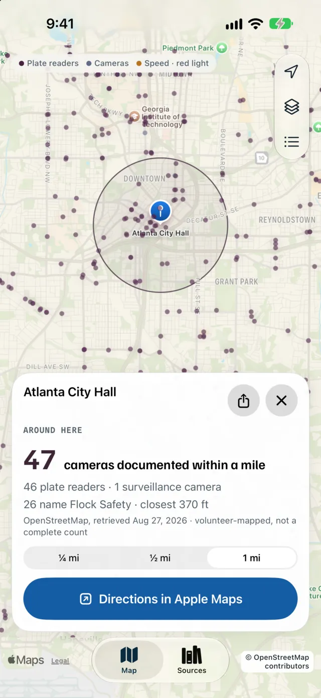
- Status
- Public TestFlight beta
- Platform
- iOS · SwiftUI and MapKit
- Role
- iOS app development · Team project
- As of
- November 8, 2026
- By
- Sri Nesan
The problem
A pin says where a camera is. It cannot say where the record came from, how old it is or how certain anyone is. People looking up public-space cameras need to inspect that evidence, not take the map’s word for it.
Nova puts source, date and confidence on every record. Camera data never changes a driving route.
What was built
The iOS map links each public-space camera location to a record. A record can show the maker, the operator, the source and whether the location has been verified in person. Where the data is silent, the record says so: “Not stated”, “Not verified in person”.
The public website explains how records are collected, mapped and corrected. Its privacy and accessibility pages state known limits.
How it works
The app is built with SwiftUI and MapKit. The flow runs from a place on the map to a record, then to its provenance: source, date, confidence.
The tradeoff is coverage against confidence. The map can grow while every record keeps showing what is uncertain. Correction and source-index controls sit on the record itself, so nobody has to go looking for them.
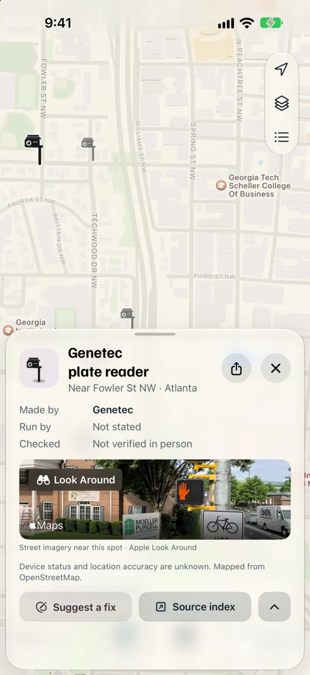
Evidence and limits
Shown here
- An iOS public TestFlight beta, recorded November 8, 2026.
- The interface as it stood when captured in September 2026.
- A public website with collection, correction, privacy and accessibility pages.
Not claimed
- Android and worldwide data are in progress. There is no App Store release yet.
- “47 cameras” is a dated example from volunteer-mapped OpenStreetMap data. It is not complete coverage and not a measure of impact.
TODO for owner · Evidence to confirm
Confirm current beta availability, a direct TestFlight link, project dates and Sri Nesan’s exact contribution to the team project.
Case study by Sri Nesan
Return to all work